 |
 |
 |
|
|
|
|
|
|
|
|
|
|
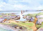 Ballintoy Harbour NE
 Ballintoy Harbour looking NE, Ballintoy, Co Antrim
Medium - Watercolour
Size – 460 x 330mm
Painted December 2017
This painting was based on a 19thc photograph by Robert French (1841 – 1917) showing the harbour just after its use for exporting basalt paving setts to Scotland and once more returns to being a fishing port.
The view looks north east with Rathlin island in the far distance and sheep island on the extreme right. Further evidence of its industrial history is shown by the large lime kiln to the right of the harbour.
To the left of the harbour is ‘Rourkes kitchen’ reputed to be named after a fisherman from Donegal who took shelter at the harbour and decided to remain.
Ballintoy harbour has become famous recently in the Game of Thrones series as being the filming location for Lordsport, the port serving Pyke, house Greyjoy’s seat of the Iron Islands. It was here that Theon Greyjoy returned and met his sister Yara, whom he didn’t initially recognise. The little harbour wall in the centre of the painting, next to the boathouse, was also used when Arya Stark left Westeros for training in Braavos.
For more information visit https://www.hbo.com/game-of-thrones
Image ©Philip Armstrong - Please respect this right
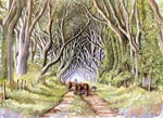 Dark Hedges
 Dark Hedges, Ballymoney, Co Antrim
Medium – Watercolour
Size – 470 x 330mm
Painted December 2017
This painting was based on personal photographs.
The stunning beech avenue of intertwining branches was planted as part of the 18thc landscaping for the Stuart mansion of Gracehill House. The house was built around 1775 and was named after James Stuart’s (a relative of King James) wife Grace. The house and grounds are currently a hotel and golf course.
Whilst the house is relatively well known locally, the atmospheric and iconic Dark Hedges has become world famous through the Game of Thrones series. Although presented in one short scene, the location as the ‘Kings Road’ has captivated millions, showing Arya Stark and Gendry escaping from Kings Landing on the back of a horse drawn cart not long after the execution of Arya’s father Eddard Stark.
Sadly, it has not been used since in the series but the popularity of the avenue has meant recent evaluations on traffic access and the impact this is having on the trees.
For more information visit https://www.hbo.com/game-of-thrones
Image ©Philip Armstrong - Please respect this right
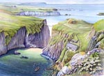 Carrick a Rede
 Carrick a Rede, Ballycastle, Co Antrim
Medium – Watercolour/Acrylic, size – 480 x 330mm
Painted December 2017,
This painting was based on personal photographs and in the composition I have attempted to show the vital relationship between the rope bridge, the fisherman’s cottage and the boat crane.
The bridge originates from the 18thc and was the only way of accessing the island and subsequently the valuable salmon fishing around that part of the north Antrim coast. The crane was used to lower and raise the two fishing boats, used to lay the salmon nets a short distance from the island. The boats were stored on a small natural platform adjacent to the crane and its winch. The courageous fishermen then carried their catch up the steps to the bridge, suspended almost 100 feet above the shore, and across the bridge which then only had a narrow plank walkway and a single hand rope.
The rope bridge has become even more popular recently in the Game of Thrones series as being the filming location for the access to the clifftop seat of the house of Greyjoy, Pyke. It was here that Balon Greyjoy was thrown by his brother Euron.
Just beyond the bridge can be seen the white limestone headland of Larrybane. This headland no longer exists, being mercilessly quarried away during the 20thc. The quarry site was used as the setting for Renly Baratheon's camp prior to his assassination by Melisandre and her ‘shadow demon’.
For more information visit https://www.hbo.com/game-of-thrones
Image ©Philip Armstrong - Please respect this right
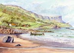 Murlough Bay
 Murlough Bay, Ballycastle, Co Antrim
Medium – Watercolour
Size – 480 x 330mm
Painted December 2017
This painting was based on personal photographs of what I believe to be the most beautiful hidden gem on the north Antrim coast.
The name Murlough may be derived from Moluag, also known as St Luan, a 6thc Scottish missionary. Just below the iconic headland of Fair Head you can see the remains of St Luan’s church, the foundations of which are still visible today.
The bay was also the favoured burial place of the Irish Nationalist Roger Casement. Although subsequently buried in Dublin Casement, in a letter to his cousin prior to his execution in 1916, appealed to her to ‘take his body back to Murlough Bay’.
Murlough Bay has been used in the Game of Thrones series mainly as the filming location for ‘Slaver’s Bay’. It was here that Tyrian Lannister and Ser Jorah Mormont ran into slavers who took them to Mereen. This was their intended destination as it was where Daenerys Targaryen currently ruled. It was also used as one of the locations for Renly Baratheon's camp. The cliff top of Fair Head is also where Daenerys and Jon Snow were filmed together on several occasions whilst at Dragonstone.
For more information visit https://www.hbo.com/game-of-thrones
Image ©Philip Armstrong - Please respect this right
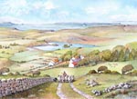 Fair Head
 Fair Head, Ballycastle, Co Antrim
Medium – Watercolour, size – 485 x 330mm
Painted January 2018
This painting was based on personal photographs and historic maps.
The remoteness and wild beauty of this headland makes it a very special and unique place. On a clear day Islay and Jura can be seen in the distance and the headland is the closest point in County Antrim to Rathin island.
There are three lakes on the headland, two of which can be seen here. Lough Doo, on the edge of the cliff, is like an infinity pool and trickles down the 200m precipice. In the middle of the painting is Lough-na-Cranagh, so named after its artificial island dating from the early medieval period.
To the left of the lake are the remains of the small medieval church, graveyard and cross of Killyowen, now sadly obliterated under farm buildings. In front of the lake is the well preserved clachan (a small hamlet normally with no community buildings or church) of Coolanlough.
The cliff top of Fair Head is the film location in the Game of Thrones series where Daenerys and Jon Snow were filmed together on several occasions whilst at Dragonstone.
For more information visit https://www.hbo.com/game-of-thrones
Image ©Philip Armstrong - Please respect this right
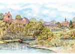 Benburb
 Benburb Priory and Castle, Benburb, Co Tyrone
Details to follow
For more information visit http://www.servites-benburb.com/about-us/
Image ©Our Lady of Benburb, Servite Priory - Please respect this right
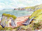 The White Rocks
 The White Rocks, Portrush, Co Antrim
Details to follow
For more information visit https://www.hbo.com/game-of-thrones
Image ©Philip Armstrong - Please respect this right
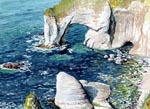 Wishing Arch
 Wishing Arch, Portrush, Co Antrim
Details to follow
For more information visit http://www.philarm.com
Image ©Philip Armstrong - Please respect this right
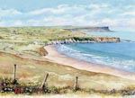 Whitepark Bay
 Whitepark Bay, Ballintoy, Co Antrim
Details to follow
For more information visit http://www.philarm.com
Image ©Philip Armstrong - Please respect this right
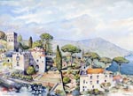 Ravello
 Ravello, Salerno, Italy
Details to follow
For more information visit http://www.philarm.com
Image ©Philip Armstrong - Please respect this right
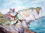 Kinbane Head
 Kinbane Head, Ballycastle, Co Antrim
Details to follow
For more information visit http://www.philarm.com
Image ©Philip Armstrong - Please respect this right
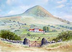 Slemish
 Farm at Slemish, Ballymena, Co Antrim
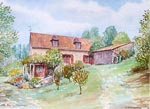 Brooks Barn
 Brooks Barn, Dordogne, France
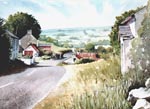 Straidkilly
 Straidkilly - The 'Slipping Village', Glenarm, Co Antrim
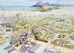 Modern Landscape
 Modern Landscape, Conjectural Location
These illustrations were displayed at the RUAS exhibition at the King's Hall, Belfast during May 2006.
The purpose was to demonstrate by reconstructions, how the Irish landscape has changed during man's occupation of this island.
The illustrations are not of any one particular part of Ireland but rather include what was considered typical Irish (mostly Ulster) landscape features. If you think the mountain range in the far distance looks like the Mournes, then you are not far wrong!
The Modern Landscape is what we are now most familiar with.
Housing estates, bypasses, supermarkets, apartment blocks, electricity pylons, a marina - the list goes on.
For more information visit http://www.communities-ni.gov.uk/
Image ©Department for Communities - Please respect this right
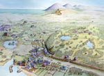 Mid Victorian
 Mid Victorian Landscape, Conjectural Location
These illustrations were displayed at the RUAS exhibition at the King's Hall, Belfast during May 2006.
The purpose was to demonstrate by reconstructions, how the Irish landscape has changed during man's occupation of this island.
The Mid Victorian Landscape shows the formal layouts of the Early Georgian period reverting back to a more natural style.
The house has been replaced and a proper demesne wall has been constructed around the estate.
A town has suddenly appeared on the left, formed due to the industrial revolution, with it's mills and workers houses.
The small seaside village in the foreground has also grown in size, with proper masonry houses being in the majority now - probably with more stones relocated from the ruined monastery.
For more information visit http://www.communities-ni.gov.uk/
Image ©Department for Communities - Please respect this right
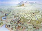 Early Georgian
 Early Georgian Landscape, Conjectural Location
These illustrations were displayed at the RUAS exhibition at the King's Hall, Belfast during May 2006.
The purpose was to demonstrate by reconstructions, how the Irish landscape has changed during man's occupation of this island.
The Early Georgian Landscape saw a dramatic transformation of the countryside due to the creation of large undefended country mansions surrounded with formal gardens, avenues, canals and follies. Even the Norman motte has been sculptured with it's own spiral pathway!
The monastery has fallen into ruins following the dissolution period and worship (and probably masonry!) transferred to the parish church in the village.
Field boundaries have also become more defined and fields 'squared up' rather than radiating from the farms in earlier periods.
For more information visit http://www.communities-ni.gov.uk/
Image ©Department for Communities - Please respect this right
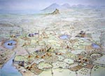 Late Medieval
 Late Medieval Landscape, Conjectural Location
These illustrations were displayed at the RUAS exhibition at the King's Hall, Belfast during May 2006.
The purpose was to demonstrate by reconstructions, how the Irish landscape has changed during man's occupation of this island.
The Late Medieval Landscape shows the monastery having developed to the European type with a large stone church, cloister and associated buildings.
The round tower would have survived from an earlier period, around the 10th century.
The Norman motte in the centre foreground is also from the earlier 11th century, literally 'thrown up' during the invasion. A small village has evolved around the motte, in the shadow of it's protection.
Most large houses needed to be defended during this period and took the form of tower houses, two of which can be seen here.
For more information visit http://www.communities-ni.gov.uk/
Image ©Department for Communities - Please respect this right
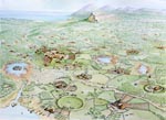 Early Christian
 Early Christian Landscape, Conjectural Location
These illustrations were displayed at the RUAS exhibition at the King's Hall, Belfast during May 2006.
The purpose was to demonstrate by reconstructions, how the Irish landscape has changed during man's occupation of this island.
The illustrations are not of any one particular part of Ireland but rather include what was considered typical Irish (mostly Ulster) landscape features.
The Early Christian Landscape shows the formation of a monastery with an early wooden church within a circular enclosure. Normally further concentric enclosures encircled this where crops were grown and animals brought to at night.
The countryside was dotted with small farms surrounding circular fortified enclosures called 'raths'. Some of these raths had multiple rings defining the status of the fort. The lake on the left contains a crannog - another fortified enclosure built on an artificial island.
For more information visit http://www.communities-ni.gov.uk/
Image ©Department for Communities - Please respect this right
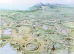 Late Bronze Age
 Late Bronze Age Landscape, Conjectural Location
These illustrations were displayed at the RUAS exhibition at the King's Hall, Belfast during May 2006.
The purpose was to demonstrate by reconstructions, how the Irish landscape has changed during man's occupation of this island.
The Late Bronze Age shows some typical settlements of this period.The large circular enclosure in the foreground is a henge, a cerimonial and sacred site. Around it are scattered various burial features - burials being very important at this time in history.
The stone circles and alignments are also features of this time and are also thought to have been cerimonial.
Quite a lot of the trees that once fully covered Ireland have been cleared at this time to make way for small farms. These farms were mostly undefended during the Bronze Age and field systems spread out radially from the small nucleus of circular huts where people lived.
For more information visit http://www.communities-ni.gov.uk/
Image ©Department for Communities - Please respect this right
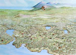 Neolithic Landscape
 Neolithic Landscape, Conjectural Location
The first real farmers that settled in Ireland did so around 4000BC. These people, as well as building more permanent shelter, organised proper farms into field systems where they both raised livestock and grew crops. In this way they were able to remain in the same area all year round, unlike their Mesolithic predecessors.
This view shows the landscape of that time with areas of the trees that once completely covered the island being cleared for farming.
The sea level has continued to recede as the land slowly rises.
This view shows the landscape of that time with areas of the trees that once completely covered the island being cleared for farming.
The sea level has continued to recede as the land slowly rises.
For more information visit http://www.communities-ni.gov.uk/
Image ©Department for Communities - Please respect this right
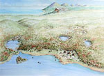 Mesolithic Landscape
 Mesolithic Landscape, Conjectural Location
This set of illustrations follow the theme of the ones prepared for the Balmoral Show (see gallery archive 2) and use the same conjectural view.
They will be published in the EHS education Key Stage 'Let's Explore' activity booklet covering life in prehistoric Ireland.
This view shows the Mesolithic Period, about 7000 BC, when the first human settlers lived a hunter-gatherer existence.
This search for food forced these early inhabitants to move around depending on the seasons. Evidence of their existence is found in some excavated settlements, where their huts and middens (rubbish heaps) show how they sheltered and fed.
For more information visit http://www.communities-ni.gov.uk/
Image ©Department for Communities - Please respect this right
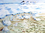 Ice Age Landscape
 Ice Age Landscape, Conjectural Location
This set of illustrations follow the theme of the ones prepared for the Balmoral Show (see gallery archive 2) and use the same conjectural view.
They will be published in the EHS education Key Stage 'Let's Explore' activity booklet covering life in prehistoric Ireland.
This view shows how the landscape may have looked around 12000 BC when the ice sheet that affected most of this island was beginning to recede.
They will be published in the EHS education Key Stage 'Let's Explore' activity booklet covering life in prehistoric Ireland.
This view shows how the landscape may have looked around 12000 BC when the ice sheet that affected most of this island was beginning to recede.
For more information visit http://www.communities-ni.gov.uk/
Image ©Department for Communities - Please respect this right
Google Maps are available for relevant items however these can slow down your browsing experience. Select Maps using the button.
| About | Process | Prehistoric | Medieval | Later | People | Landscapes | Terms of Use | Links | Contact |
| © Philip Armstrong, Larne, N.Ireland 2022 This site only uses functional cookies |